tier 01
infrastructure
the physical layer. servers, storage, uptime. what keeps the applications online every minute of every day.

the principle
the intelligence is not visible.
its applications are.
applications
 enlarge
VENTIM
open
enlarge
VENTIM
open
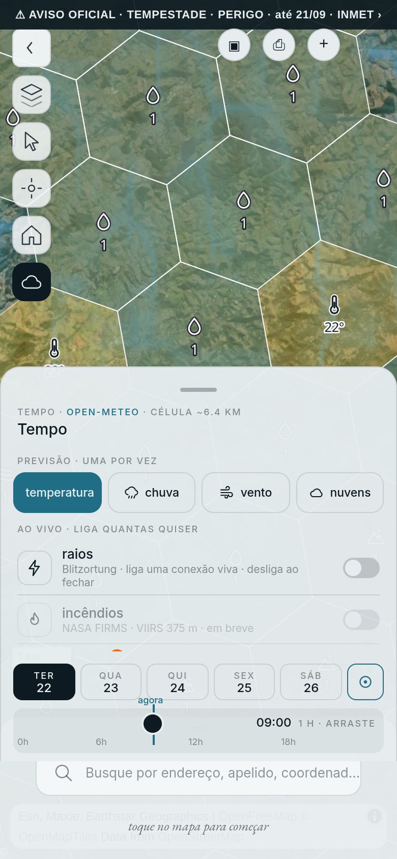
Official warnings matched to your exact location, and flood or landslide risk screened before the expensive study — so it goes only where it is needed.
 enlarge
SAARA
by licence
enlarge
SAARA
by licence
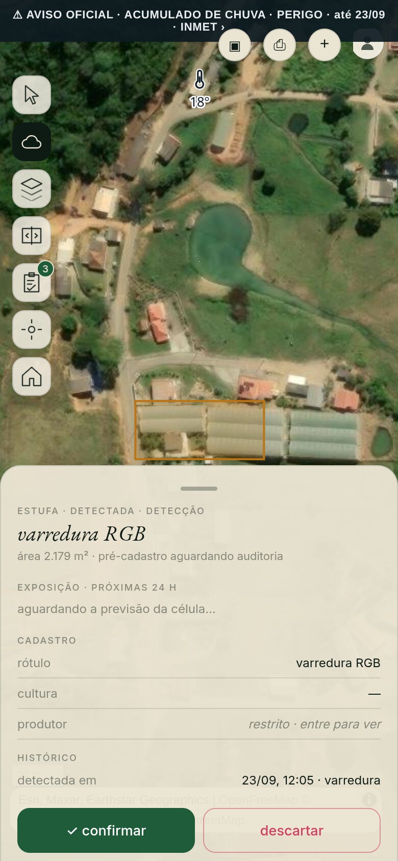
Greenhouses found by sweeping half-metre imagery, each one measured and held for a person to sign. Detection proposes; a person decides.
 enlarge
mapim
by licence
enlarge
mapim
by licence
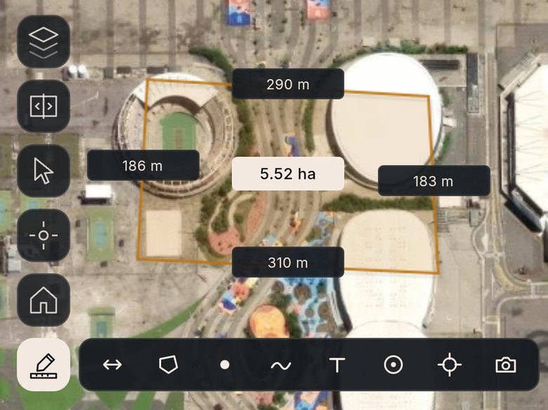
785,000 street addresses from the city cadastre, answered in real time — on the open standards your GIS team already uses. And any area you trace on the map comes back measured, before anyone walks the site.
Treasury measured on-chain, services supervised, a kill switch that answers to no model. Sponsorship accounted to the cent.
A digital assistant that is not a bot, and says so when asked. Skills you switch on one at a time; anything outside them is discarded on arrival.
Access to the licensed applications is arranged directly. open a licence conversation.
support · sponsor
tier 01
the physical layer. servers, storage, uptime. what keeps the applications online every minute of every day.
tier 02
the invention layer. new algorithms, new backtests, the r&d that becomes the next application.
tier 03
the time layer. years, not quarters. sustaining the work so it outlasts any single cycle.
no institutional backing. every sponsor conversation starts with what matters to you — and what the work needs.
open a sponsor conversationVENTIM — flood and landslide risk, derived with the threshold and the source in sight close
SAARA — the sweep finding greenhouses in the image, and the detection card with its area close
mapim — four taps close a polygon over the site, and it closes measured: 5.52 hectares, every side in metres close